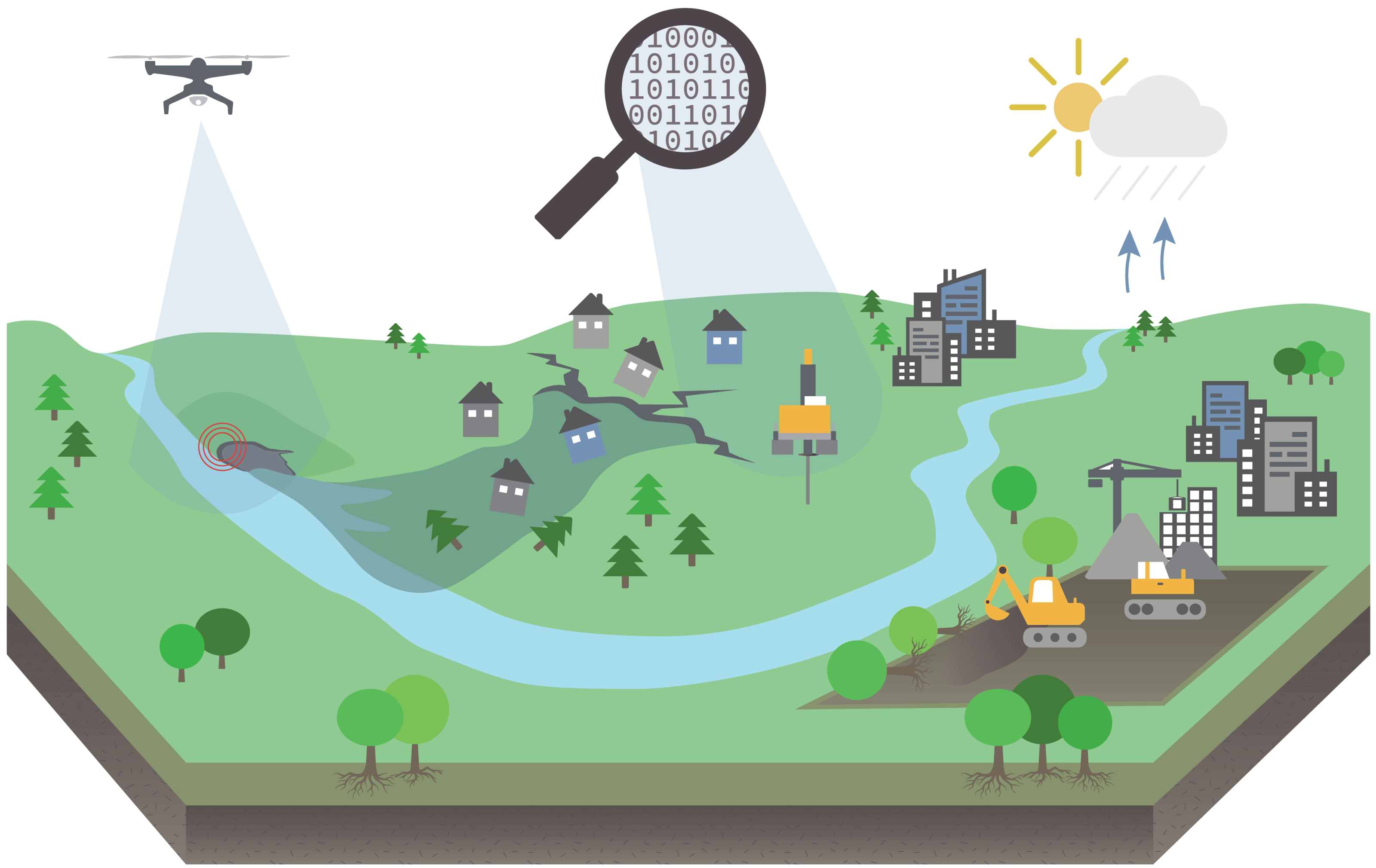
Managing quick clay areas often conflicts with local economic and environmental goals. This project prioritises protecting people and the environment, considering climate change, by focusing on sustainable risk management through multidisciplinary collaboration and hazard mapping.
The hazard, consequence, and risk mapping for quick clay (QC) areas in Norway, developed in the early 2000s, is now outdated due to new technologies and the growing impact of climate change. New methodologies, including remote sensing and machine learning (ML), are needed to update risk assessments and monitor quick clay areas.
Many existing QC zones need re-evaluation, and large areas remain unmapped. This project aims to apply ML, develop remote sensing technologies and model landslide behaviour. It also seeks to create sustainable, multidisciplinary solutions for environmental, economic, and social challenges in QC regions. The plan is divided into six sub-objectives and five research packages to address these issues.
Objectives:
- Apply machine learning (ML) and other statistical approaches to large existing geological, geotechnical datasets to assess probability of quick clay deposits
- Develop, document and promote a nationwide use of remote sensing technology to streamline the monitoring of landslide hazard in quick clay terrain.
- Develop methodology for the analysis of initial stress conditions in natural QC slopes
- Develop a tool for modelling the retrogression and runout of QCL
- Quantify the hazards that affect the stability of QC slopes
- Establish clear metrics and recommendations to support impact assessments of mitigation work in ravines, farmlands and other pristine QC terrain to ensure optimal environmental, economic and social solutions.
Work Packages:
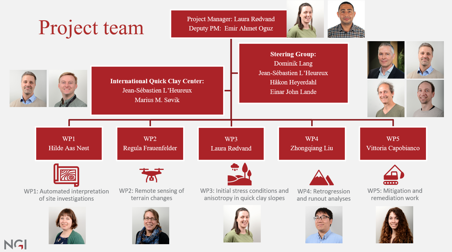
The strategic plan (SP) for improving hazard and risk mapping of quick clay landslides (QCL) includes five key work packages (WPs), each focused on different aspects of advancing the methodology:
- WP1: Investigate machine learning (ML) and statistical-based approaches to interpret site investigation (SI) data. This includes interpretation of total soundings, rotary pressure soundings and CPTu. Combined with samples, the interpreted results will be presented as the probability of presence of quick clay at each borehole in GIS software.
- WP2: Develop, test and validate selected remote sensing methods to streamline the monitoring of erosion and subsequent landslide hazard in
quick clay terrain. - WP3: Assess the initial stress conditions in quick clay slopes, through the use of lab testing and advanced numerical modelling. Sensitivity analysis of the factors that affect the stability of QC slopes.
- WP4: Calibrate the strain-softening process for large deformations in quick clay. This includes coupling material models and the material point method (MPM) in both 2D and 3D to simulate the behaviour of quick clay landslides, from initiation to retrogression and runout.
- WP5: Establish the environmental impacts of QCLs by documenting recent events. Review sustainable mitigation and recovery measures used internationally, incorporating cost-benefit analyses to ensure optimal environmental, economic, and social solutions for managing quick clay landslide risks.
These work packages form the core research areas of the project, contributing to a comprehensive approach to risk management in quick clay regions.
More information about each WP is available under the Work Packages tab above.


