A climate-induced landslide in Greenland was detected by seismic monitoring stations around the world
"The landslide created a 200-meter-high tsunami that sloshed back and forth in the narrow fjord for nine days," explains Finn Løvholt from NGI – the Norwegian Geotechnical Institute.

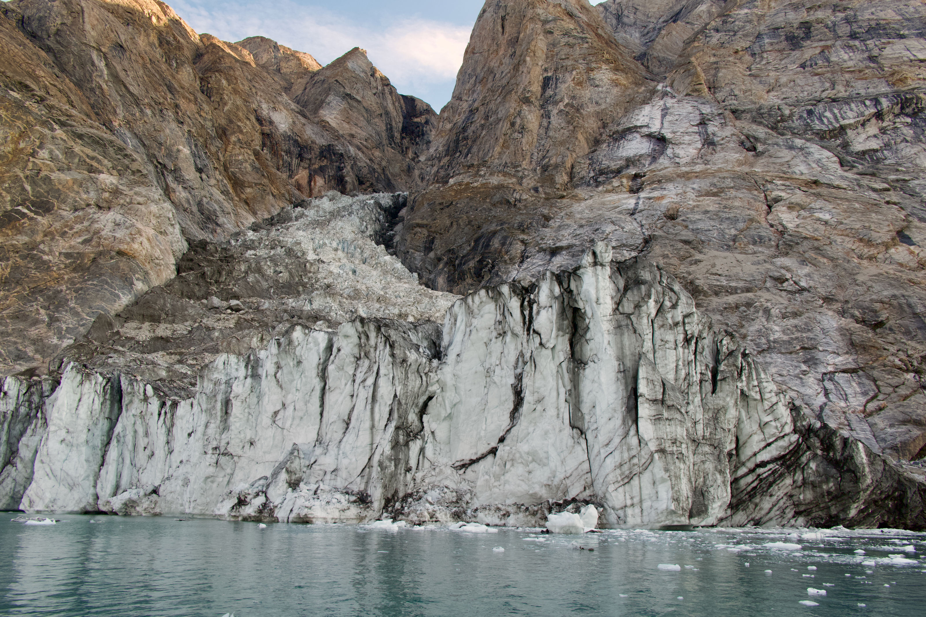
The image shows the hill side from the sea, a few weeks before the slide. ( Søren Rysgaard, Danish Army)
This is the conclusion of a recently published research article in Science.
A unique seismic wave lasting for nine days led to the discovery of the tsunami in Dickson Fjord, but it took scientists a long time to find the explanation. The seismic waves were caused by a massive landslide. At least 25 million cubic meters of rock and ice fell into the remote fjord. There were no people nearby to witness the wave and the landslide.
"The tsunami in Dickson Fjord is one of the highest observed in recent times," says Steven Gibbons from NGI.
More important than ever to monitor previously stable regions
According to the study, the landslide was triggered by the collapse of a mountain peak that once stood 1.2 km above the fjord. The reason is climate change.
"The mountain collapsed because the ice at its base had thinned over the past decade. The triggering of the landslide is likely connected to climate change," continues Gibbons.
With rapidly accelerating global warming, it will become more important than ever to characterize and monitor previously considered stable regions and provide early warnings for these massive landslide and tsunami events.
"As a landslide researcher, an interesting aspect of this study is that this is the first landslide and tsunami ever observed from East Greenland. It also shows how climate change can be linked to events with major consequences in the Arctic," explains Sylfest Glimsdal from NGI.
Challenging researchers' models
The seismic signal was initially so confusing that researchers struggled for a long time to understand how it originated. It took several detailed computer calculations to show how the tsunami made the Earth vibrate for nine days.
"The calculations showed that the water sloshed back and forth every 90 seconds, which matched the oscillation observed in the seismic waves. The perfect match between the calculated wave period and the period in the seismic signals shows how the force from the water mass creates seismic energy in the Earth's crust," says Finn Løvholt.
The tsunami challenged the classical numerical models previously used to simulate wave movements.
"An exceptionally high numerical resolution was needed to explain how this event in Greenland could last so long. This opens up new possibilities for understanding how we can best model tsunamis," concludes Glimsdal.

Before and after the landslide. ( Søren Rysgaard, Danish Army)


Steven Gibbons
Principal Researcher Climate Adaptation and Hydrodynamics steven.gibbons@ngi.no+47 986 13 288

Sylfest Glimsdal
Principal Engineer Climate Adaptation and Hydrodynamics sylfest.glimsdal@ngi.no+47 909 72 669