Ground-Based Radar Monitoring (GRI)
NGI offers ground-based radar interferometry (GRI) for high-precision monitoring of ground and structural movements. Unlike satellite-based InSAR, GRI provides continuous measurements from a fixed location, making it ideal for tracking changes in unstable terrain or infrastructure in real time.

Ground-based radar interferometry has, in contrast to satellite InSAR a fixed location for all measurements enabling highly accurate and continuous frequent monitoring of infrastructure and instabilities in the ground, slopes and rock walls. The aim is to identify movements that can lead to hazards such as rock failure or fall and the increased load on infrastructure that can help guide mitigation measurements.
What is GRI used for?
- Monitoring unstable slopes, rock walls, and landslide-prone areas
- Tracking structural movement in tunnels, bridges, and dams
- Supporting early warning systems and hazard mitigation efforts
- Complementing satellite InSAR and drone-based surveys for full situational awareness
GRI is especially useful in areas with steep terrain, vegetation cover, or limited satellite visibility. It delivers frequent, accurate data that helps engineers and decision-makers respond quickly to changes on the ground.
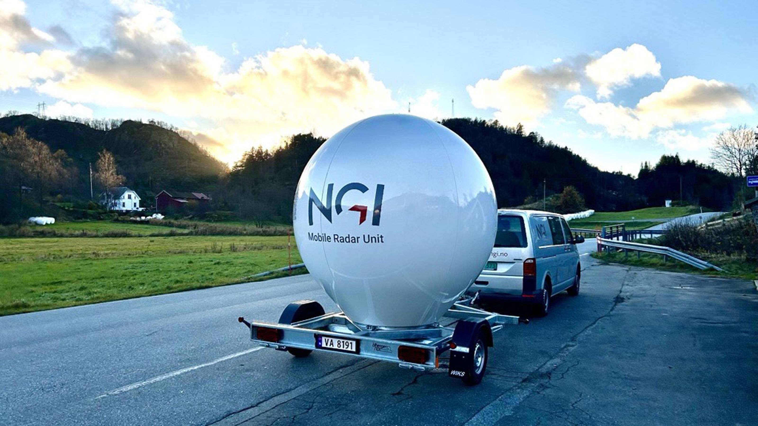
Mobile Radar Unit
To support research and emergency monitoring, NGI now offers a trailer-mounted GRI system designed for fast deployment in the field. This mobile unit enables:
- Quick setup in remote or hazardous locations
- Real-time data collection for short-term campaigns or urgent assessments
- Flexible use in research projects, infrastructure inspections, and geohazard response
The system is available for NGI-led projects and collaborative field campaigns. It enhances our ability to deliver timely insights where and when they’re needed most.
Real-Time Monitoring with NGI Live
All data collected from NGI’s ground-based radar systems — including the new trailer-mounted unit — can be streamed directly into NGI Live, our real-time monitoring and alert platform.
NGI Live provides:
- Interactive dashboards for visualizing movement over time
- Automated alerts when thresholds are exceeded
- Secure access for project teams, clients, and emergency responders
This integration allows for fast decision-making and improved safety in areas where ground movement poses a risk. Whether used for long-term monitoring or short-term campaigns, NGI Live ensures that critical data is available when it matters most.


Dyre Oliver Dammann
Head of Section Remote Sensing and Geophysics Remote Sensing and Geophysics dyre.dammann@ngi.no+47 930 10 310

