- NGI /
- Projects /
- Case studies /
- Broads North sea Coastal wetlands
Broads North sea Coastal wetlands
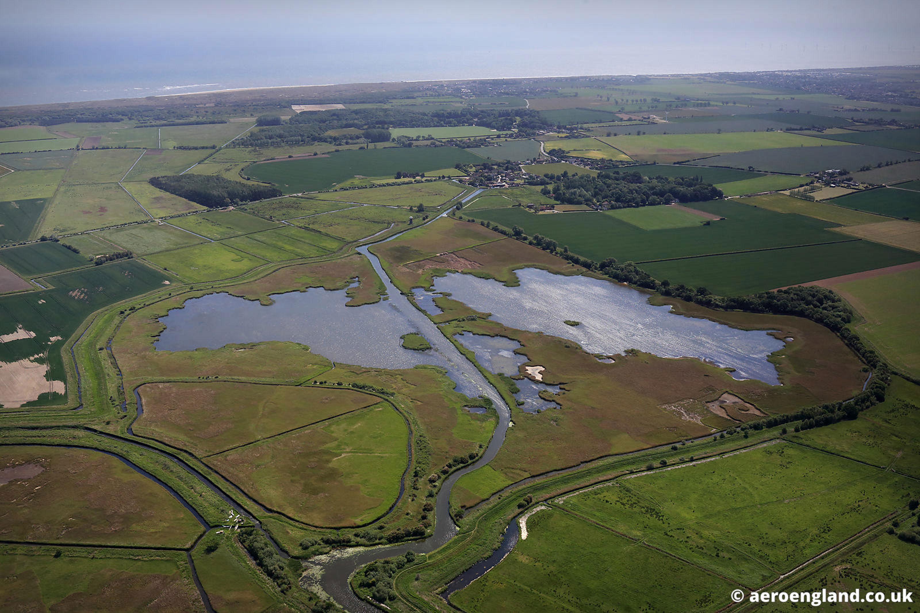
The Broads is the UK's most extensive lowland wetland and falls within the Anglian River Basin District catchment on the East Coast of England, approximately 200 km North-East from London.

General description
The Broads area consists of a network of rivers and shallow lakes surrounded by calcareous fens and drained marshes providing a large variety of habitats and landscape types, which are linked to form a lowland wetland ecosystem.
The Broads executive area is managed by the Broads Authority, a special statutory authority with similar responsibilities to those of the English National Park Authorities, i.e. conserving and enhancing the natural beauty, wildlife and cultural heritage of the area, and promoting opportunities for the understanding and enjoyment of the special qualities of the area by the public. However, the BA, unlike other National Park Authorities, is not subject to the Sandford Principle, which mandates preferential treatment for nature conservation.
So the BA's statutory duties, which include protecting the interests of navigation, require a balancing approach across a range of sometimes competing interests. The boundary of the Broads executive area is tightly drawn around the flood plains and lower reaches of the three principal rivers (Bure, Yare and Waveney) and encompasses an area of approximately 300 km2; the environmental change pressures it has to manage, however, have their origins in the wider catchment and beyond.

History
The low-lying, mainly open and undeveloped landscape of the Broads comprises a complex (freshwater, brackish and saline zonal area) interconnected wetland mosaic of rivers, broads (shallow lakes), fens, marshes and woodland rich in rare habitats and species, some of which are unique to the area. The `broad´ originated as large pits dug for peat to provide fuel during medieval times. In the 14th century these peat diggings flooded and became part of an extensive communication network for transporting fuel, building materials including reed for thatch, and livestock and their products, especially wool.
Fishing and wildfowling were also significant elements of this predominantly agricultural economy. The advent of the railways in the mid-19th century and motor vehicles in the 20th century brought most river-borne commerce to an end, but made the Broads accessible as a popular tourist destination for boating holidays, revealing to a wider audience its national and international nature conservation significance.

Nature protection and climate change
The Broads executive area includes 28 Sites of Special Scientific Interest (SSSI). Almost one third of these are designated as National Nature Reserves and most of the SSSI network is designated as internationally important for nature conservation and has either Special Protection Area (SPA) or Special Area of Conservation (SAC) status under European legislation. A large proportion of the area is also designated as an internationally important wetland under the Ramsar convention.
Even if the area is naturally protected, wetland degradation and loss continue in the Broads. The main causes are land use change and agricultural development; further growth of water based tourism; increased risk of saline intrusion and sea level rise, increased flood risk ( fluvial and marine) and neglect of fen and carr woodland habitats. The impact of agricultural activities over the years has changed from land conversion (i.e. drainage schemes to convert marshland into intensive grazing or arable cultivation) to diffuse pollution mostly arising from outside the Broads boundary (e.g. from farm and road run-off), which cause eutrophication in the shallow lake systems of the Broads and ecosystem regime shifts over relatively short periods of time.
The rivers and connected broads are also intensively used for recreational boating; in the light of climate change and carbon footprint concerns and the consequent demand for `local´ holidays, this pressure may increase. However, water quality in parts of the Broads has improved markedly in recent decades, helped by improvements and new initiatives in sewage treatment, agri-environmental practices and the boating industry.

The Broads lie within the East of England, the region of the UK with the lowest annual rainfall. The region has warm summers and mild winters, and is at risk from saline inundation from the North Sea because of sea surge. The Broads area is also prone to fluvial flooding events. As a consequence, a comprehensive flood defence system is in place, built largely after the 1953 flooding catastrophe. But the flood defences are expensive to maintain and will not provide an on-going uniform level of protection across Broadland in the future if climate change related sea level rise predictions prove correct.
At the same time, concern over national food security may once again encourage more agricultural activity with spillover effects on wetlands, water resources (groundwater depletion as irrigated cropping regimes are further developed) and flood protection investments. There is a complex relationship between flood defence policy, stakeholder perceptions of flood risk and ecosystem change, and the BA has to operate by making sometimes pragmatic trade-offs, subject to EU Directives and national legislation constraints.
Social communities and economics activities
The economy of the Broads is intrinsically linked to its environment. Considering that most of the land in the Broads executive area is privately owned (the Broads Authority itself owns less than 2 km2), including large tracts belonging to NGOs like the wildlife trusts, RSPB and National Trust, at the local level there is a potential conflict of use in the Broads. Local residents, farmers and land owners, water companies, conservationists, official agencies, holiday makers (local and non local), the hire boat and boat building industry, services industry, and private boat owners all bring different interests and requirements into the political and management process.
The tourism industry is very important for the Broads, but at the same time the congestion and pollution threats related to it highlight the need for regulation and conservation action in the area. It is likely that increased tourism demand will be a key issue in the future, stimulated by the growing regional population (particularly in the eastern sections of the region) whose nearest "wild" area is the Broads.

Much of the land that provides local employment lies beyond the Broads executive boundary, including the urban surrounds of Norwich, Great Yarmouth and Lowestoft. Within it, the economic characteristics continue to reflect its navigable wetland environment and rural setting, with tourism, boatbuilding and agriculture being key industries. Traditional local skills such as reed and sedge cutting, thatching and mill wrighting make up a small but important part of the Broads economy. The marine industry is significant within the Broads and in the region more generally.
Peculiarities of the region
The Broads is especially renowned for many species of birds. Teal and wigeon spend the winter on the open broads, and birds such as reed and sedge warblers, and the rarer Cetti's warbler, inhabit the reedbeds. The marsh harrier has made a comeback and now breeds successfully in the fens.
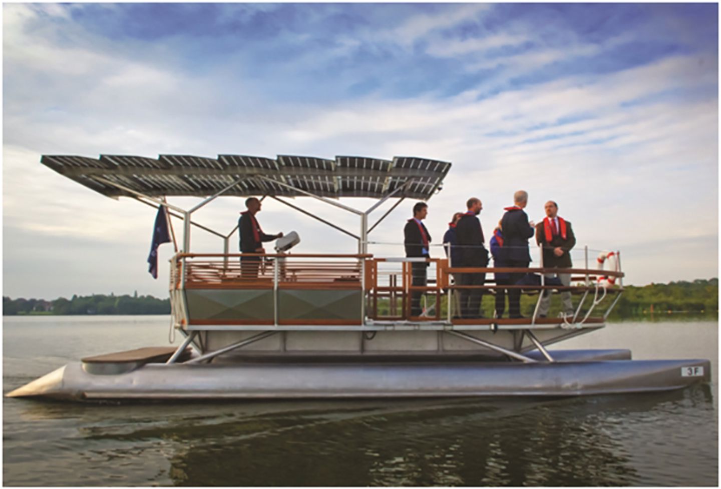
The flagship species of the fens is the bittern, with 23-28% of the UK population of booming males. Numbers of bitterns have increased in recent years following restoration of fen habitat and improvements to water quality. One of the best ways to observe them is enjoying a silent ride on the Broads Authority solar boat. The Broads is the only wetland national park equivalent area in England and Wales.


========================================
Based on the information from: http://www.broads-authority.gov.uk/index.html
========================================
Contact:
- Maria Giovanna Palmieri, Sub-project manager, M.G.Palmieri@uea.ac.uk